Flat Branch Falls
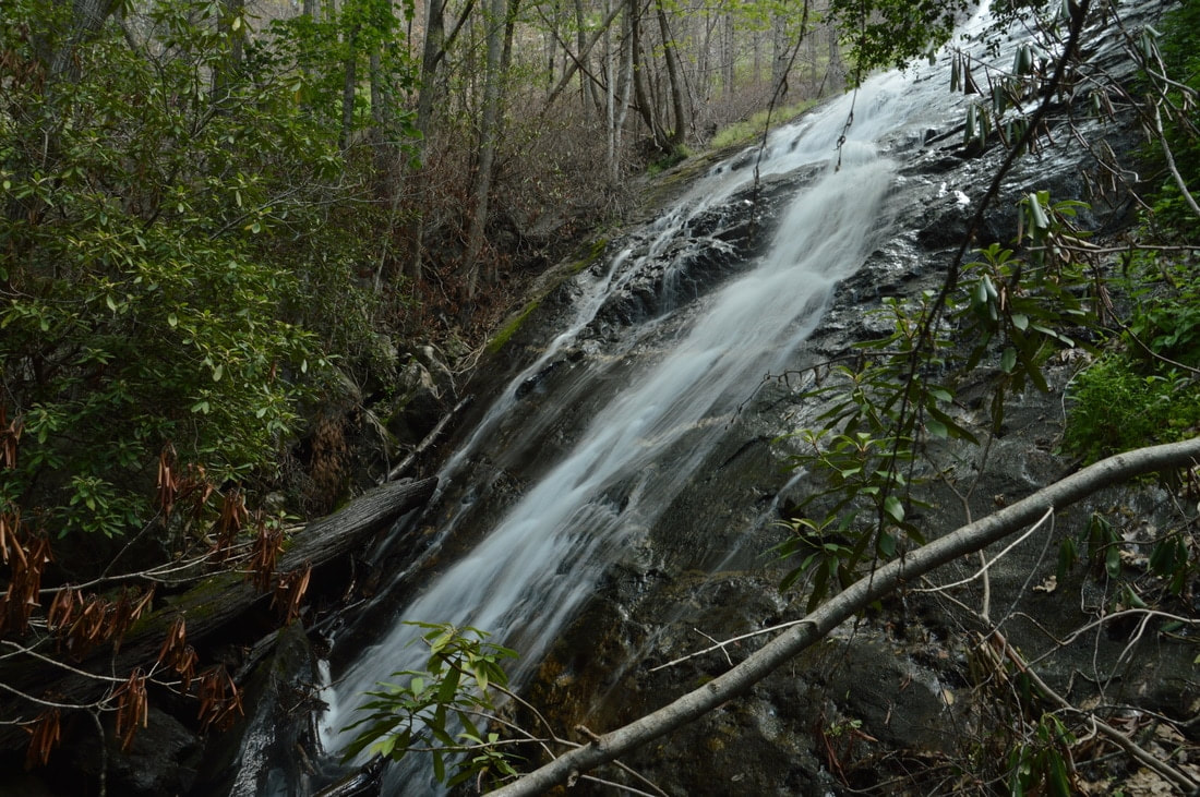
Photo by Mark Oleg
Waterfall Info: This is a very tall waterfall on Flat Branch, a tributary of the Tallulah River draining from the east. You can see most of it from the base, though a little of the upper slide remains hidden. Best seen during wetter periods. It is very confusing that there is another Flat Branch Falls just a few miles to the west (this Flat Branch drains into Charlie's Creek).
Landowner: Chattahoochee National Forest
Height: 240 Feet
Type: Double Slide (Double-Tier)
County: Towns
Access Info: This waterfall used to be accessed by a very steep, fire-damaged scramble path from Tallulah River Road (FS 70). I was able to hike this path without much difficulty in May 2017. Upon my attempted revisit in May 2020, I found that all of the dead rhododendron (destroyed by the Rock Mountain fire) has completely collapsed onto the path. The path to the falls is fully impassable after the first 20 feet. At this point, reaching this waterfall will require a strenuous bushwhack or creekwalk, unless a new path forms.
Waterfall Location: 34.946499, -83.548069

First in Georgia!
Get Mark's brand new
guidebook to 700+ falls.