Little Skeenah Creek Falls
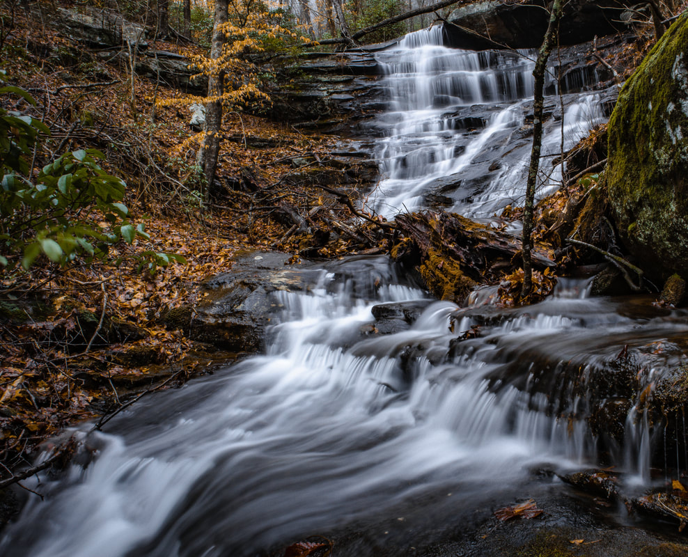
Photo by Morgan Kephart
Waterfall Info: This is the lowermost and most significant waterfall on Little Skeenah Creek. It is located 0.1 mile downstream from a point marked 'Falls' on the topographic map.
Landowner: Chattahoochee National Forest (Cooper Creek Wildlife Management Area)
Height: 30 Feet
Type: Sliding Cascades (Double-Tier)
County: Fannin
Access Info: Park at the trailhead for the BMT where FS road 816 meets GA 60 (Tooni Gap). From there, take the BMT North towards Wallalah Mountain for 0.71 miles. At this point (34.77273, -84.15927) there will be an old forest service road (Little Skeenah Road) about 75 feet off trail from the BMT on your right side. You will leave the BMT at this point and continue your journey to the east along Little Skeenah Road. When you have reached the old logging road (in approximately 75 feet), you will notice a very pronounced path at (34.77272, -84.15899). Take a left onto this path (Little Skeenah Road) and continue. This is the path you will be on for the rest of the journey. You will notice the remnants of old gravel and culverts along the way. It was a major access road and used for logging (formerly known FS Road 763). Continue for 1.72 miles down Little Skeenah Road until you reach a point where Little Skeenah Road crosses Little Skeenah Creek. At this point, you should have hiked a total of 2.43 miles. (0.71 on BMT and 1.72 on Little Skeenah Road). At this point, leave Little Skeenah Road and walk your way directly alongside of Little Skeenah Creek. The falls will come into view a few hundred feet upstream.
Waterfall Location: 34.77751, -84.13683
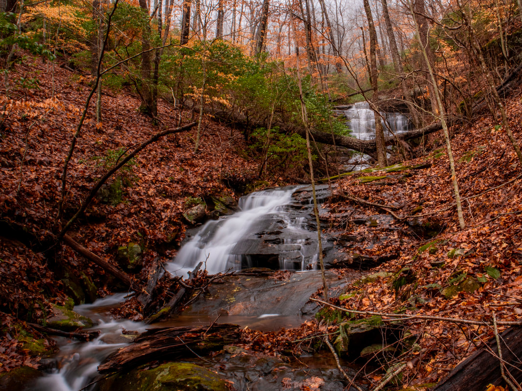
Overview of whole waterfall. Photo by Morgan Kephart
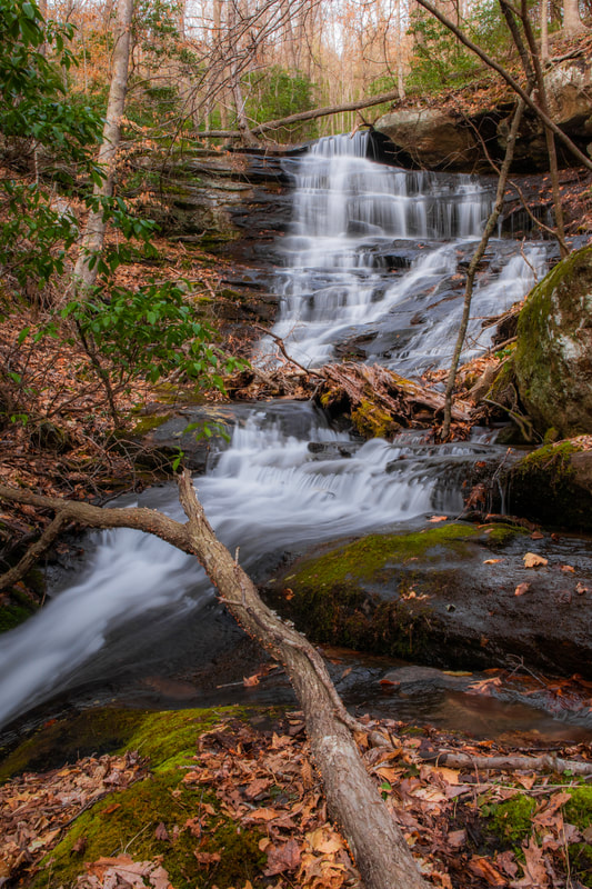
Photo by Morgan Kephart
|
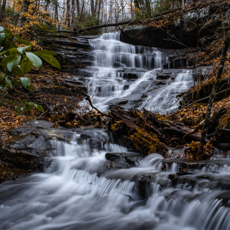
Photo by Morgan Kephart
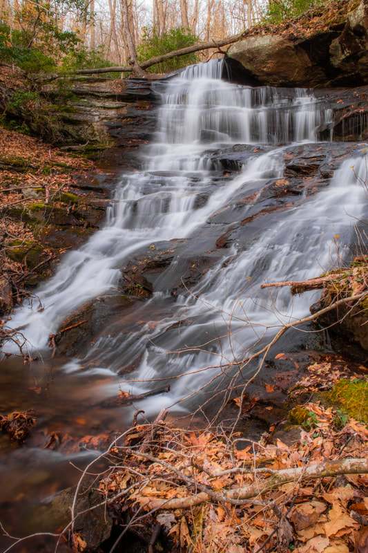
Photo by Morgan Kephart
|

First in Georgia!
Get Mark's brand new
guidebook to 700+ falls.