Lower Bear Gap Branch Falls

Photo by Mark Oleg
Waterfall Info: From the bottom, this is the first waterfall on an unnamed tributary of the Coleman River that has been dubbed Bear Gap Branch, as it flows from Bear Gap. Best seen during wet weather.
Landowner: Chattahoochee National Forest (Southern Nantahala Wilderness)
Height: 60 Feet
Type: Free-Fall (Single-Tier)
County: Rabun
Access Info: An old, gated forest road - the continuation of Coleman River Road (FS 54) - leads to Bear Gap Branch. From there, an easy bushwhack upstream along Bear Gap Branch will bring you to this waterfall.
Waterfall Location: 34.986726, -83.512071
Click here for Bernie Boyer's report with detailed access information
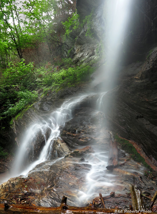
Another view of Lower Bear Gap Branch Falls. Photo by Bruce Roberts

First in Georgia!
Get Mark's brand new
guidebook to 700+ falls.