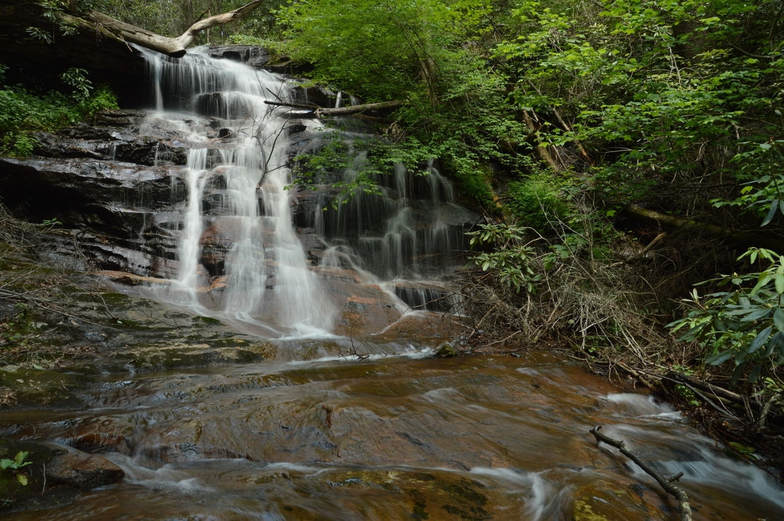
Middle Spoilcane Falls
Waterfall Info: Coming from the top, this is the second waterfall on Spoilcane Creek.
Landowner: Chattahoochee National Forest (Chattahoochee Wildlife Management Area)
Height: 25 Feet
Type: Cascades, Drops, & Slides (Multi-Tier)
County: White
Access Info: An unofficial trail along an old road leads from Highway 75 to Spoilcane Creek and eventually to the waterfall. You'll still need to scramble down the steep bank to get to the base.
Waterfall Location: 34.787347, -83.747245
Click here for Mark Oleg's report with detailed access information

First in Georgia!
Get Mark's brand new
guidebook to 700+ falls.

