Nash Pit Falls
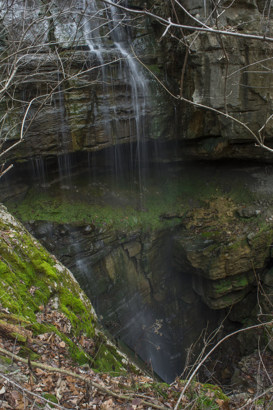
Photo by Mark Oleg
Waterfall Info: This is a wet-weather waterfall on an unnamed stream that spends most of its time underground. The falls is unique as it drops into a cave. It's best seen after heavy rain.
Landowner: Crockford-Pigeon Mountain Wildlife Management Area
Height: Over 60 Feet (continues to drop into the pit)
Type: Steep Slide & Free-Fall
County: Walker
Access Info: To get to Nash Pit Falls, follow the Chamberlain Trail for 1.5 miles. Then, make a 1000-foot off-trail bushwhack to the right. It's moderately steep through open woods. You'll cross a normally dry gully just before Nash Pit Falls.
Waterfall Location: 34.685634, -85.357964

First in Georgia!
Get Mark's brand new
guidebook to 700+ falls.