Sandy Bottom Falls
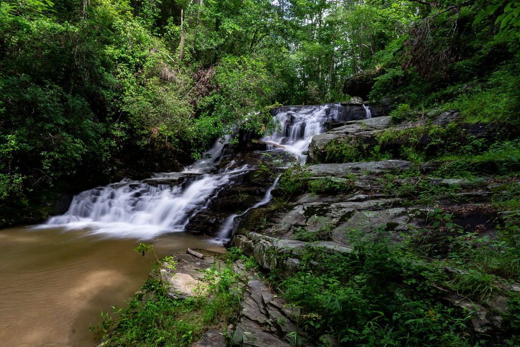
Photo by Bernie Boyer
Waterfall Info: This is the upper of two beautiful waterfalls in a small gorge along the Middle Fork of the Broad River. Its name comes form the large, sandy pool at the base.
Landowner: Chattahoochee National Forest (Lake Russell Wildlife Management Area)
Height: 20 Feet
Type: Double Sliding Cascade (Double-Tier)
County: Habersham
Access Info: This waterfall is accessed by a faint path from FS 89 inside Lake Russell WMA. FS 89 is best accessed via FS 89A from the gate at the end of Sellers Road.
Waterfall Location: 34.55299, -83.43789
Click here for Bernie Boyer's report with detailed access information

First in Georgia!
Get Mark's brand new
guidebook to 700+ falls.