Upper Darnell Creek Falls
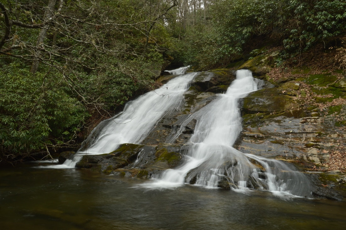
Photo by Mark Oleg
Waterfall Info: From the bottom, this is the second waterfall on Darnell Creek. It's the last waterfall on Darnell Creek before the confluence of Thomas and Ramey Creeks. A significant section of the waterfall lies around a bend and isn't visible from the base.
Landowner: Chattahoochee National Forest
Height: 65 Feet
Type: Slides & Cascades (Multi-Tier)
County: Rabun
Access Info: Reaching this waterfall involves a short, steep off-trail scramble off Darnell Creek Road (FS 150).
Waterfall Location: 34.958840, -83.355453
Click here for Mark Oleg's report with detailed access information

First in Georgia!
Get Mark's brand new
guidebook to 700+ falls.