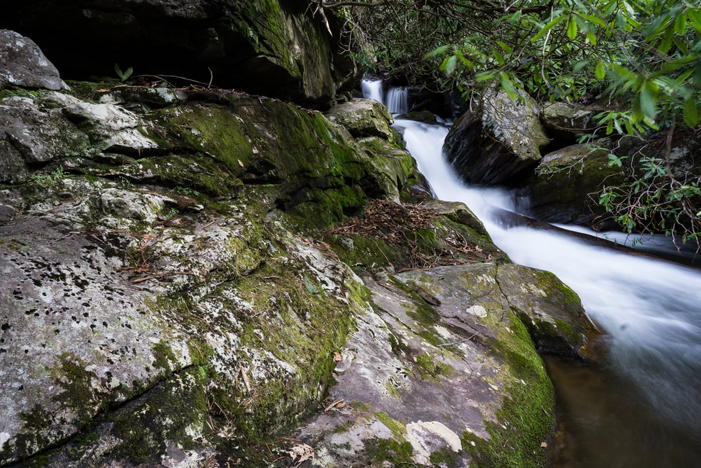
Upper Queen Branch Falls

Photo by Bernie Boyer
Waterfall Info: Coming from the bottom, this is the second waterfall on Queen Branch. Upstream on Queen Branch is a small, third waterfall (really just a cascade - scroll down for a photo).
Landowner: Chattahoochee National Forest (Swallow Creek Wildlife Management Area)
Height: 35 Feet
Type: Stairstep Cascade & Sheer Drop (Double-Tier)
County: Towns
Access Info: Begin hiking past the gate at the end of FS 305, a side road off Corbin Creek Road (FS 698). The gate is at the end of a large camping area just past a vehicle ford of Corbin Creek. You will shortly reach an unofficial trail along an old logging road that branches off and follows Corbin Creek downstream to Queen Branch, fording Corbin Creek twice along the way. You will be on the west side of Corbin Creek when you're directly across from the Queen Branch confluence - from here, it is a short but thick bushwhack to the waterfalls on Queen Branch. You may be able to see the waterfalls through the trees from the trail.
Waterfall Location: 34.835735, -83.689562
Click here for Bernie Boyer's report with detailed access information
Click here for more of Bruce Robert's photos from Corbin Creek and Queen Branch

The gorgeous upper section of Upper Queen Branch Falls. Photo by Bruce Roberts
|

12-foot cascade/waterfall above Upper Queen Branch Falls. Photo by Greg Ford
|
A small canyon waterfall on Corbin Creek on the way to Queen Branch from FS 305. Photo by Bernie Boyer

First in Georgia!
Get Mark's brand new
guidebook to 700+ falls.